Powered By Blogger

Search This Blog

Tuesday, June 15, 2010

Bearing Through Bear Creek


As the title would suggest, this hike is very difficult.  You basically start somewhere near the Big Bear Lake Dam and hike straight down into the valley that houses Bear Creek.  As you can see in the photo on the right, the valley is extremely deep.  I would rate this hike as strenous because of the steep entry into the canyon, but more so because of the terrain around the creek bed.  There are only faint trails as you move downstream.  There is tons of boulders, thick brush (including stinging nettles), and lots of fallen trees to navigate past. 

Looking back, I think we should have explored upstream because the going was so tough downstream that it was tirelessly demoralizing.  This was probably mile for mile, the toughest hike I've ever been on, and I consider myself to be in great shape (minus the beer). 


As far as the fishing, we did see a lot of trout in the stream and as I expected, they were easily spooked because they are native brown trout.  This is a rare area in SoCal, because you are able to access a remote area that still has native trout.  I know this is a popular area with flyfishermen, but there was very limited access to throw a fly.  Many overhanging trees lined the creek, as well as tall brush.  I was hard to sneak up on the fish because of all obstacles.  Again this was downstream of the where the trail hits the creek, so upstream could have been different, but it appeared to be more of the same.  There were some excellent pools and trout holding in less that 1 foot of water.  The largest trout I saw was in the 12 inch range, with many in the 8-10 inch range.  REMEMBER TO CATCH AND RELEASE!


It is obvious why nobody fishes here: difficult terrain, crazy hike in, overgrown brush, quasi sketchy dirt road on the way in, and quad busting hike out.  The overall distance of the trail is only 1 mile, but you gain/lose a whopping 1100 feet in that mile.

The bugs were the worst I have ever experienced in the So Cal Mtns.  I swear that the same 6 flies were following me the entire way up the trail.  I must have squashed 35 bugs on my body, and that is a conservative estimate.  I did not notice too many mosquitoes, but the constant buzzing near my ears was enough to drive a man insane.

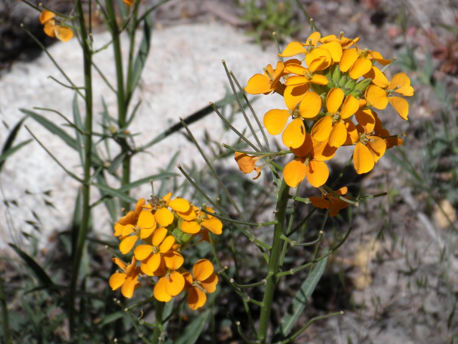
There were many flowers in bloom near the creek, with the yellow one above (of which I don't know the name) as well as some sort of iris (I believe it's called mountain Iris).

Before returning, there are lots of negatives to consider about this hike, but I think with a little more knowledge about the place, the reward could easily outweigh the risk.


Wednesday, June 9, 2010

McGrath SB and Santa Clara River Preserve

Okay, so first of all, I wouldn't really call this a hiking post. The trails near McGrath State Beach were, in my opinion, quite meager. There all went into a dead end and when they did dead end, it was either into a road, or the stagnant Santa Clara River. Being that it hadn't rained in more than a month, I was not surprised to see the river stagnant. This river is a typical SoCal river in that it only flows to the ocean during the rainy season. Otherwise, the natural sand berm builds up and blocks the river's access to the ocean.


On our particular trip, the low clouds and fog hung around for the entire weekend, which at the beach, makes my level of motivation seriously lack. Anyway, we did check out all of the trails and even went on the main trail that is behind the sand dunes. (side note on the sand dunes: It was refreshing to see how a "real" SoCal beach should look, with iceplant and dunes and not houses right up to the water). The only bummer about the dunes is that they are protected habitat for nesting birds from March 15 to November 15 and you have to walk around that area. Not a big deal, merely an inconvienence.
As far as the campground goes, I thought our site was really nice. It had good privacy because there were plenty of trees to block the neighbors. The ground was nice and soft (I only know this because my air matress failed; never trust someone's elses gear) due to the campground being on the flood plain of the Santa Clara. Also, behind most of the sites in the park, there is a large grassy area for bocce, football, horshoes, redneck golf, etc. Some people had set up their tents, but I would not want to do that because the area is really exposed, and I hate having my tent in the sun. Dogs are allowed in the campgound, but not on the beach (got to love the state of California). I find it funny that federal land allows dogs, and state land doesn't.

My biggest complaint was the cost of the campground. Because every campground on the southern/central coast was booked, we had to reserve online and it cost $35 plus an $8 reservation fee. You could almost get a motel in Vegas for that price. And on top of that, they charge $10 for a 2nd vechicle. You can bring a car and a trailer, but you can't bring 2 cars. That doesn't make any sense and is just another gross mismanagement of OUR state land by the horribly mismanaged state of california (not capitalized on purpose).

Friday, April 16, 2010

Joshua Tree Willow Hole


This 7 mile roundtrip hike is well worth it. I found the trail to be very level, but there were some extremely soft spots in the narrower wash areas. The "Hole" had quite a bit of water in it, but you could see the water line was about 12 inches above it's current level. The peak was probably during that late January period of rain when we got 4 or 5 days of rain in a row.

We were not fortunate enough to see any wildlife, but there were conducting a SAR training mission down through Rattlesnake Cyn. That canyon is in a separate drainage from Willow Hole, but since the hole is at the end of the drainage, it's only a quick climb to Rattlesnake Cyn.

The SAR guy told me that they had already gone on 20 rescues this year (as of Apr. 10). He also mentioned that most of them were rescues and not recoveries. The fact that he said "most" made me want to ask if there had been any fatalities this season, but I refrained. They pretty much form a relay system from their team in the field back to the nearest trailhead, which in this case happened to be the Boy Scout Trailhead. One funny thing I noticed was that the SAR vechicle was a Lexus. Looked like someone's private car and my guess is that these guys are volunteers.

After the wet winter, all of the desert flora was either blooming, or getting ready to bloom. The yucca, joshua tree, and one of the cacti with stunning red flowers were just beginning to bloom. Don't do this hike if the temp is over 85 degrees. We had a nice cool day with some high clouds blowing in from time to time. I am personally not a person who likes to torture myself by hiking in hot weather, especially in the desert, so this trail is better done in the winter/spring. Especially because the willow hole would not be as full in the summer.
Posted by Picasa

Thursday, April 8, 2010

Deep Creek via Hooks Creek Rd.


Getting There: Get to Lake Arrowhead and then head toward Cedar Glen. When you get to the gas station at Cedar Glen, turn right onto Hooks Creek Rd. Continue to follow this road until it dead end's into Splinter's Cabin Trailhead. Part of the road is dirt, but 4x4 isn't required.
Minus the poor fishing, this hike was amazing. The hike follows a section of the Pacific Crest Trail and offers magnificent views of the creek from above. Heading downstream, the trail is ever so slightly downhill, and easy on the way back. This area appeared to have recently been burned (i think it's been about 5 years as of this post, but that's a guess) therefore, there is very little shade. I don't envision there would have been much more shade anyway because the ecosystem is pretty desert oriented, with the occasional oak, but mostly scrub oak and high elevation drought tolerant plants. I would estimate that we only hiked 2 miles from the trailhead. The one problem I saw with trying to fish on this hike was that the trail was high above the creek, so access was a bit limited, as we only crossed 3 footpaths leading down to the creek on our hike.

I managed to get an aeriel view of Aztec Falls, said to be the best swimming hole in CA. It looked like you could have jumped, but with the water being high, it was hard to see the bottom, in case a new boulder has been submerged by the storms/runoff this season. Also, the water temp was in the mid 50's, so even though it was a warm day (about 75), I would probably want to wait until later in the season.

Fishing: Mike and I did not catch any trout, nor did we get any bites. The creek was appeared to be flowing very high, but being that this was my first visit to the area, I can neither confirm nor deny that statement. I used a super duper, panther martin rooster tail, and the tried and true bubble fly method (my prefered method). This creek is filled with great runs and a number of slow moving pools. The water had a brown tinge, but was still quite clear (if that makes sense). Mike was fishing with artificial worms. This area is a wild trout stream, so you are only allowed to use lures with barbless hooks. No bait fishing at all. The limit is 2 fish and they must be at least 8 inches long. This is definitely somewhere I will return to fish.

Jed: He did very well on this hike, except I have determined that dog's and fishing don't mix. He gets very instinctual when I fish, and wants to chase my lures, or any animals that might be nearby. He would clearly make a great bird dog, but not so much when it comes to fishing. I think I will leave him home on fishing trips from now on. There were a courting pair of mallard ducks that he kept harrassing, but I have to admit it was pretty funny. The ducks kept coming up to us thinking we would feed them (of course we wouldn't, this is one of my biggest pet peeves when people feed wild animals) and Jed would chase them back in the water and swim after them until they were far enough away to satisy him.
Posted by Picasa

Saturday, April 3, 2010

Black Star Canyon Falls


Okay, since the OC Register already did a huge Sunday front page article on the falls, I figure why not. These falls are amazing, yet having them go "mainstream" means more people will be attracted to attempting this hike. It isn't overly difficult, but one mistake and it's a long way out, especially with the lack of meadows for a heli transport.

We all have Dave Whiting to thank for the article, not sure if you've seen it, but the guy who wrote Whiting the letter to promote the falls and ultimately ended up with his name in the paper, looks like quite a tool. I guess it was only a matter of time, but damn, it's unfortunate to see it exposed in such a manner.

2010 in February was a solid time to see the falls. The flow was very strong, being that the watershed isn't all that big for these falls. A week of rain in January, followed by consistent rains for the next month or so contributed to the solid flow at Black Star Cyn Falls this year.

Side Note: Jack Tuttle is the world's angriest man. Those of you who have encountered him know what I'm talking about. When we were almost back to the car, past the locked gate, he was chatting it up with some other hiker (quite a rare sight from what I understand) when he noticed that we had wet feet. He proceeded to provide us with his usual accusatory rhetoric. I mean, the funny thing is that he tells people the same thing and after some time, it gets quite old. He claimed to be taking a photo of my car, but the funny thing was he was holding the camera such that the lens was facing him, and I was staring at the viewfinder. Never listen to this guy, he thinks anyone who goes on the road is trespassing, when in fact, the road is public, as well as the creek once you enter the Cleveland National Forest

Tuesday, March 30, 2010

Hiking Crack in the Wall, Lake Havasu, AZ


Posted by Picasa


The hike from SARA park just outside Lake Havasu City is about a 6.2 mile roundtrip. The trail was in good condition. To get to the trailhead. You turn into SARA park on the Arizona side of Lake Havasu around mile marker 175. If you can't find it, then you don't deserve to hike here. My timing for the wildflowers was impeccable. With the slow warming trend that had recently hit the desert, the flowers were quite showy. Essentially, you are following a drainage wash that flows into Havasu. There is a great slot canyon on this hike that runs for about 200 yards. When I went there were still some stagnant pools inside the slot, and I had to retrace my steps and find a way out of the canyon to the top of the ridge.

Once on the ridge, the views of Lake Havasu were superb. You can make great time if you choose the high route, but I always prefer staying in the canyon, because there tends to be more life there. The best part of the ridge trail was the flowers. As you can see from the beaver tail cactus bloom above. Also, brittlebush and mojave lupine were really hitting their stride.

Reaching the trailhead: As I said before, turn into SARA park at mile 175 and follow the road past the baseball fields until you see the trailhead sign on the left hand side.

Why Am I Blogging???

I began this blog with a vision of being able to share a lot of my hiking experiences with other people who love trampling around, scrambling over rocks and other activities associated with being outdoors. My black lab/pit (I think) Jed and I have been hiking together since he was a young pup, which now amounts to almost three years.

I often have been browsing the internet looking for information on various hikes, but the info is always so limited, I thought I would start an informational page where I can share my various experiences. Sometimes I hike just to hike, sometimes I hike to fish, and sometimes I just like being outside. But no matter the reason, I just like logging miles. Hope you enjoy my posts and pics as I get this blog up and running.